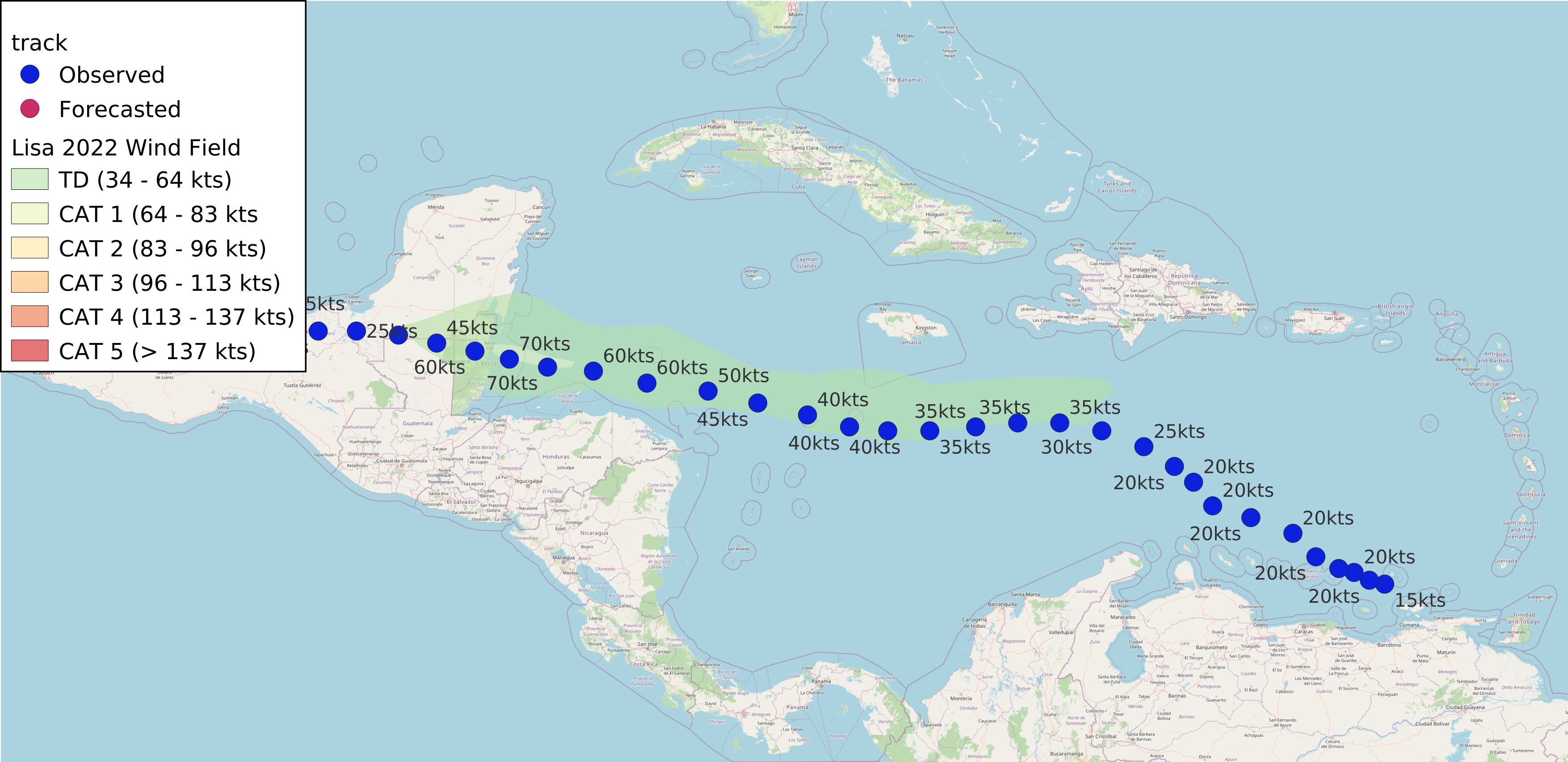
Lisa 2022
AL152022 Advisory Number 23,
DISCLAIMER This is not official information or modeling, I’m just a dude on the internet. Please follow all guidance from NOAA and your local officials.
Windfield Map

- as of 2022-11-07T15:21:43+00:00
- 100px per degree
- GWAF 0.9
- No Friction
- default radius of maximum wind is 15kts
Useful Links
- NOAA Active Cyclones
- Tropical Tidbits
- https://www.nhc.noaa.gov/text/refresh/MIATCPAT5+shtml/050835.shtml
- https://www.nhc.noaa.gov/refresh/graphics_at5+shtml/083835.shtml?cone
Data Files
File List:
lisa2022_100x100.csvlisa2022_100x100.pnglisa2022_100x100.wldlisa2022_100x100_2022-11-07T152100+0000.jpeg
Official Advisory Discussion
At 400 AM CDT (0900 UTC), the center of Tropical Depression Lisa was located near latitude 19.8 North, longitude 95.5 West. The depression is moving toward the north-northwest near 3 mph (6 km/h), and a slow motion toward the north is expected today. Lisa or its remnants are then forecast to stall or drift southward through the remainder of the weekend.
Maximum sustained winds are near 30 mph (45 km/h) with higher gusts. Gradual weakening is forecast, and Lisa is expected to become a remnant low later this morning.
The estimated minimum central pressure is 1008 mb (29.77 inches).