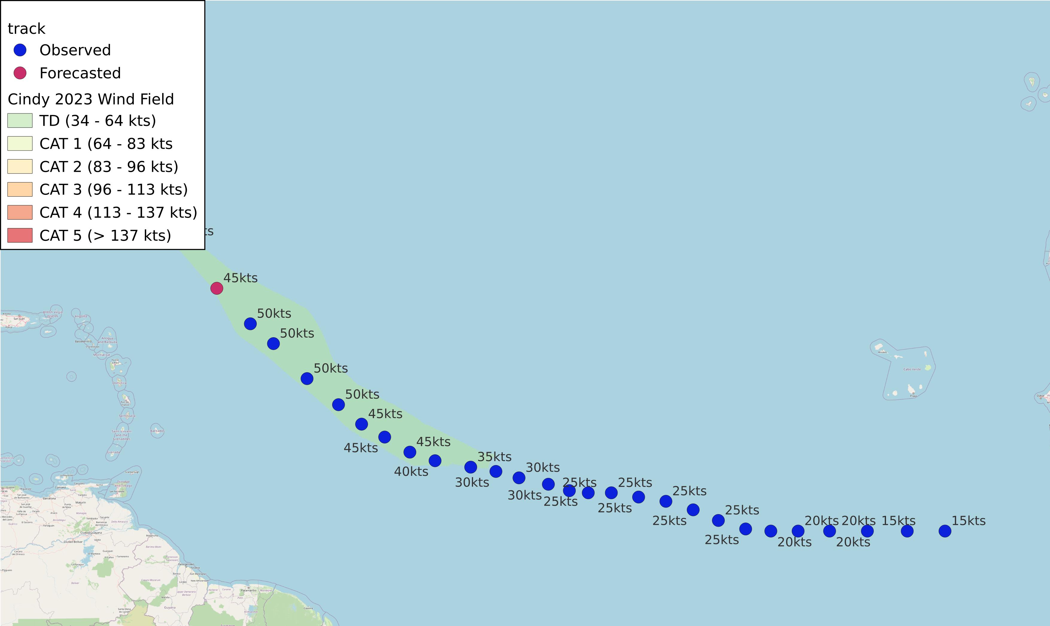
Cindy 2023
AL042023 Advisory Number 11,
DISCLAIMER This is not official information or modeling, I’m just a dude on the internet. Please follow all guidance from NOAA and your local officials.
Windfield Map

- as of 2023-06-25T00:48:49+00:00
- 100px per degree
- GWAF 0.9
- No Friction
- default radius of maximum wind is 15kts
Useful Links
- NOAA Active Cyclones
- Tropical Tidbits
- https://www.nhc.noaa.gov/text/refresh/MIATCPAT4+shtml/242041.shtml
- https://www.nhc.noaa.gov/refresh/graphics_at4+shtml/204207.shtml?cone
Data Files
File List:
cindy2023_100x100.csvcindy2023_100x100.pngcindy2023_100x100.wldcindy2023_100x100_2023-06-25T004800+0000.jpeg
Official Advisory Discussion
At 500 PM AST (2100 UTC), the center of Tropical Storm Cindy was located near latitude 17.8 North, longitude 54.7 West. Cindy is moving quickly toward the northwest near 21 mph (33 km/h) and this motion is expected to continue, with a gradual slowdown. On the forecast track, Cindy should pass well to the northeast of the northernmost Leeward Islands.
Maximum sustained winds remain near 60 mph (95 km/h) with higher gusts. Weakening is forecast over the next several days, and Cindy could degenerate into a trough of low pressure by the middle portion of this week.
Tropical-storm-force winds extend outward up to 60 miles (95 km) from the center.
The minimum central pressure recently measured by the Air Force Reserve Hurricane Hunters is 1005 mb (29.68 inches).