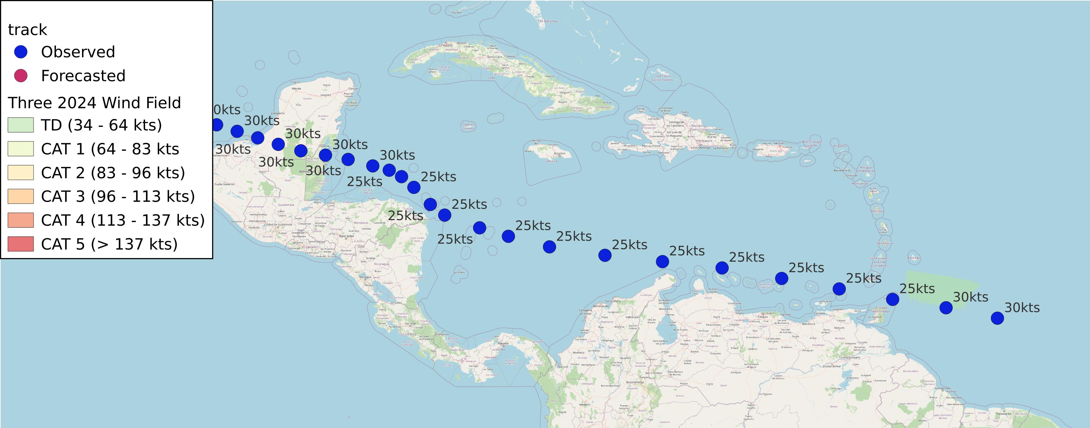
Three 2024
AL032024 Advisory Number 1,
DISCLAIMER This is not official information or modeling, I’m just a dude on the internet. Please follow all guidance from NOAA and your local officials.
Windfield Map

- as of 2024-06-30T21:04:51+00:00
- 100px per degree
- GWAF 0.9
- No Friction
- default radius of maximum wind is 15kts
Useful Links
- NOAA Active Cyclones
- Tropical Tidbits
- https://www.nhc.noaa.gov/text/refresh/MIATCPAT3+shtml/302044.shtml
- https://www.nhc.noaa.gov/refresh/graphics_at3+shtml/204909.shtml?cone
Data Files
File List:
three2024_100x100.csvthree2024_100x100.pngthree2024_100x100.wldthree2024_100x100_2024-06-30T210400+0000.jpeg
Official Advisory Discussion
At 400 PM CDT (2100 UTC), the center of Tropical Depression Three was located near latitude 19.7 North, longitude 94.9 West. The depression is moving toward the west near 12 mph (19 km/h) and this general motion should continue until it dissipates over eastern Mexico late Monday.
Maximum sustained winds are near 35 mph (55 km/h) with higher gusts.
Some strengthening is expected, and the cyclone is forecast to
become a tropical storm before it reaches the coast later tonight.
The system is expected to weaken and dissipate after it moves
inland over eastern Mexico.
The estimated minimum central pressure reported by aircraft reconnaissance is 1006 mb (29.71 inches).
HAZARDS AFFECTING LAND
Key messages for the depression can be found in the Tropical Cyclone Discussion under AWIPS header MIATCDAT3 and WMO header WTNT43 KNHC.
RAINFALL: Tropical Depression Three is expected to produce rainfall totals of 4 to 8 inches across portions of eastern Mexico into Monday, with localized maximum totals of 15 inches possible. This rainfall will result in areas of flooding, with mudslides possible in areas of higher terrain.
For a complete depiction of forecast rainfall and flash flooding associated with Tropical Depression Three, please see the National Weather Service Storm Total Rainfall Graphic, available at hurricanes.gov/graphics_at3.shtml?rainqpf
WIND: Tropical storm conditions are expected in the warning area later tonight.
NEXT ADVISORY
Next intermediate advisory at 700 PM CDT. Next complete advisory at 1000 PM CDT.
$$ Forecaster Roberts